SOUTH DUNDAS – In an effort to combat potential flooding this spring on Lake Ontario, and to deal with high water levels throughout the Great Lakes, more water is being emptied through this region than usual this time of year.
Water levels on the St. Lawrence River above the Iroquois dam are dropping, while water levels on Lake St. Lawrence are at historic lows.
In December 2019, the International Joint Commission gave permission for the regulatory board for Lake Ontario and the St. Lawrence River to deviate from the controversial Plan 2014 management plan. Critics blame the plan for much of the shoreline flooding on Lake Ontario in 2017 and 2019.
Water levels on all five Great Lakes are well above seasonal averages with Lake Huron and Lake Erie each one metre above normal. Lake Ontario is nearly one metre above the seasonal average at 74.99 metres: the average is 74.16 metres.
Currently water levels on Lake Ontario are near the levels that caused flooding along the shoreline during the spring and summer of 2019.
Until now, the International Lake Ontario St. Lawrence River Board operated higher-than-normal water outflows through the Moses-Saunders power dam and Long Sault control dam, both near Cornwall. Throughout the summer of 2019, outflows were near or at the safe navigation limit of 10,400 cubic metres per second. Even at that, vessels transiting the St. Lawrence Seaway were subject to several restrictions to combat the effects of high currents.
The close of the navigation season on the waterway has meant the ILOSLR can open the taps to the dams even further. On January 2nd, the board announced it expected to exceed the 10,400 m3/s limit by 300 m3/s, That is the equivalent of four Olympic-sized swimming pools of water, or 10.6 million liters.
According to a release from the ILOSLR, the board will continue to deviate from Plan 2014 during any mild weather, increasing outflows from the dams when ice formation will not occur.
“[The ILOSLR] will look for any and all opportunities to remove additional water from Lake Ontario prior to the spring,” said the release.
Lowering Lake St. Lawrence creates a siphon-effect to help lower Lake Ontario water levels. Reported water levels above the Iroquois control dam in Brockville have been lowered by nearly 20 centimeters from last summer’s high point. The process takes time as the amount of water that can flow through the Iroquois dam is limited, even with all gates wide open.
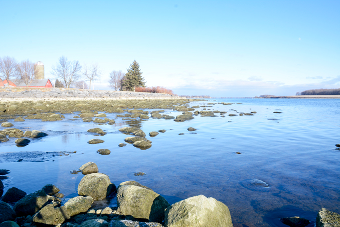
The impact of the near record low water levels can be seen along the Lake St. Lawrence shoreline.
West of Morrisburg, residents were seen walking on the riverbed 50 feet from the usual shoreline at Loyalist Park on Lakeshore Drive.
East of Morrisburg, most of the former village of Aultsville has been drained of water, with curious explorers walking the old village streets.
In Ingleside, a new beach has appeared where the waterfront was. According to local anglers there normally is three-to-four feet of water in that area.
Fluctuating water levels in Lake St. Lawrence will cause some changes to the ice cover used by ice fishing enthusiasts.
Rob Caldwell, Canadian secretary for the ILOSLR board said that ice cover can take a lot of stress by the significant draw-downs of the lake. He told The Leader that the board has commissioned Dr. Hung Tao Shen, an ice engineer with Clarkson University in Potsdam NY to study the issue to verify local knowledge.
“Anglers will likely be quite surprised by the considerable changes,” he said. “They might end up finding their previous holes sitting in the mud on certain days.”
Caldwell added that if the anglers have fished the area for years, most would be used to the fluctuating levels.
The board cautioned residents and anglers to use an “excess of caution when on, or around, the ice.”
Discover more from Morrisburg Leader
Subscribe to get the latest posts sent to your email.